Coordinates | |||||
| Country: | |||||
| State: | |||||
| Seat: | Magellan | ||||
| Incorporated cities: | 13 | ||||
| Assembly: | 11 members | ||||
| Time zone: | Papa Time Zone (UTC-3) | ||||
| Area code(s): | 23, 30, 45, 74 | ||||
| Post code(s): | 9001-9189, 9241-9259 | ||||
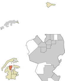
Magellan Borough, a borough in the state of Alyeska, is slated to be the most populous borough in the Federation, consisting of the city of Magellan and 12 other communities. In fact, McMurdo City is the largest city in the nation only because Magellan Borough is divided into 13 cities, whereas the former consists of one single city that covers three boroughs.
Government[]
Magellan Borough is governed by a mayor (elected every three years) and an Assembly (elected every three years with staggered terms). The borough uses the strong mayor form of municipal government. The borough does not have a judicial branch, as all courts in the state of Alyeska are state-level courts. The borough also does not have a law enforcement apparatus. Cities are responsible for their own police departments, and any unincorporated part of the borough is patrolled by Alyeska State Patrol.
Borough government is responsible for schools, libraries, parks, transportation, and health care.
Geography[]
Magallan Borough occupies most of the northwestern peninsula of James Ross Island. It has two coasts: Brandy Bay and the Prince Gustav Sound to the west and St. Martha Cove and Croft Bay to the east. The northern boundary of the borough is an international border shared with the Czech Republic's Mendel Polar Station. The southwestern boundary is shared with the Municipality of Gentoo.
A mountain range runs through the center of the borough, separating the Abernethy Flats suburbs from the Granada Shores region of the city of Magellan. Numerous rivers and streams flow in the borough.
Major divisions[]
A listing of major regions within the borough, along with incorporated communities:
- Abernethy Flats: Aurora, Astoria, Brandy Bay, Glendora, Helada Beach, Los Planos, Mendel, Rio Marron
- The Valley: Magellan (Main Habitat, University Area, Airport)
- St. Martha Cove: Magellan (Downtown, Casino District, Ferdinand Hills, Gellanwood), Santa Marta
- North Bay: Buena Vista, Magellan (Alturas, Granada Shores, North Magellan)
- South Bay: Belair Heights, Magellan (South Magellan), Villa Paraiso
Adjacent Boroughs[]
- Gentoo Municipality (southwest)
- Hillcrest Municipality (southeast)
- Prince Gustav Borough (north)
- Vega Island Borough (east)
Transportation Infrastructure[]
Magellan Borough has an extensive freeway system, centered around Transantarctic 5. It also has four main monorails and a bus system.
Highways[]
- Transantarctic 5 (James Ross Freeway): Main route from Astoria to Erebus through Magellan and Hillcrest.
- Transantarctic 205 (Magellan Loop): Forms the southern part of the T-5/T-205 loop around the Main Habitat and Downtown area of Magellan.
- Transantarctic 405 (Abernethy Loop): Loop through the foothill communities of Abernethy Flats and North Bay communities of Buena Vista and Granada Shores.
- Transantarctic 605 (Rio Marron Freeway): Links the foothill communites of Abernethy Flats to Astoria.
Monorails[]
- Red Line (Magellan): Airport, Main Habitat, Magellan Center, Magellan Ferry Terminal, Casino District, Gellanwood, North Magellan, Granada Shores, Alturas, Buena Vista
- Yellow Line (Abernethy Flats): Airport, Aurora, Los Planos, Rio Marron, Glendora, Mendel, Buena Vista
- Green Line (Astoria): Airport, Aurora, Helada Beach, Astoria, Astoria Ferry Terminal
- Blue Line (South Bay): Magellan Center, South Magellan, Villa Paraiso, Belair Heights, Hillcrest (where it becomes "Pink" Line)
Ferries[]
- Astoria-Port Ross Ferry
- Astoria-Gentoo Ferry
- Bellevue-Magellan Ferry
Education[]
Primary Schools[]
The floor of each residential building has its own primary school room. These schools are administered as Magellan Primary Schools
Middle Schools[]
There are two middle schools for each high school.
High Schools[]
- Abernethy High School
- Aurora High School
- Granada Shores High School
- Magellan High School
- South Bay High School
Colleges and Universities[]
- Magellan Community College
- Abernethy Community College
- University of Alyeska

